Huge landslide in Greenland triggered ‘mega-tsunami’ that caused Earth to vibrate for nine days
A massive landslide in remote Greenland sent Earth vibrating for nine straight days, unleashing a mysterious seismic signal that left scientists scrambling for answers.
The landslide, which took place last year in September, triggered a massive tsunami in Dickson Fjord, creating puzzling tremors and a planet-wide “hum”, scientists said. The hum, unlike any typical earthquake activity, sparked a global investigation to uncover its origins and potential impact.
It was eventually traced to a colossal rockslide that triggered a mega-tsunami, researchers from University College London (UCL) and others have found, an event they say is directly linked to the climate crisis.
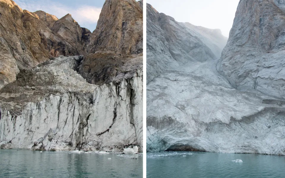
The landslide began when a 1.2km-high mountain peak collapsed into the fjord, unleashing a 200m-tall wave through the narrow waterway.
This wave, initially towering at 110m, created vibrations that were detected by seismometers worldwide, from the Arctic to Antarctica.
“When I first saw the seismic signal, I was completely baffled,” said Dr Stephen Hicks from UCL Earth Sciences, one of the study’s co-authors.
“Even though we know seismometers can record a variety of sources happening on Earth’s surface, never before has such a long-lasting, globally traveling seismic wave, containing only a single frequency of oscillation, been recorded.”
The seismic signal, unlike typical earthquake rumbles, consisted of just one steady, monotonous frequency. This unusual “hum” prompted scientists to label it a “USO” – an unidentified seismic object.
But it wasn’t until reports of a tsunami in Greenland reached researchers that they began to connect the dots.
When they did, a team of 68 scientists from 40 institutions collaborated to reconstruct the event. Using a combination of satellite imagery, field measurements, and advanced mathematical models, the researchers demonstrated that the vibrations were caused by water sloshing back and forth in the fjord, a phenomenon that continued for nine days.
The landslide, according to the study published in journal Science, was triggered by the thinning of a glacier at the foot of the mountain, which could no longer support the weight of the rock above it. This was a direct result of the ongoing effects of climate crisis, which has significantly weakened Greenland’s glaciers in recent years.
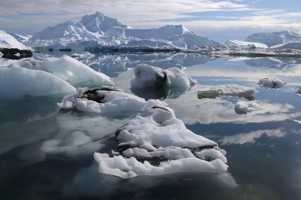
Earlier studies have found that the Greenland ice cap is losing an average of 30m tonnes of ice an hour due to the climate crisis, a result of rapidly increasing global temperatures due to carbon pollution created by burning coal, oil and gas.
“This [landslide] event highlights the intricate interconnections between climate change in the atmosphere, destabilisation of glacier ice, movements of water bodies, and Earth’s solid crust,” said Dr Hicks.
“This is the first time that water sloshing has been recorded as vibrations through the Earth’s crust, travelling the world over and lasting several days.”
Lead author Dr Kristian Svennevig from the Geological Survey of Denmark and Greenland said that this was the first recorded landslide and tsunami in eastern Greenland.
“As a landslide scientist, an additional interesting aspect of this study is that this is the first-ever landslide and tsunami observed from eastern Greenland, showing how climate change already has major impacts there,” he said.
The tsunami was so unique that it tested the limits of current scientific models for simulating such events.
“This unique tsunami challenged the classical numerical models that we previously used to simulate just a few hours of tsunami propagation,” said co-author Anne Mangeney from Université Paris Cité, Institut de Physique du Globe de Paris.
“We had to go to an unprecedentedly high numerical resolution to capture this long-duration event in Greenland. This opens up new avenues in the development of numerical methods for tsunami modelling.”
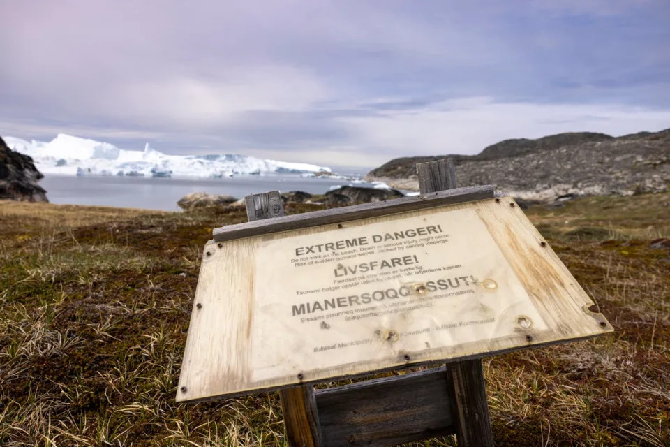
It measured up to 4m high and damaged a research base 70km away and destroyed cultural heritage sites.
While no cruise ships were near the fjord at the time, the researchers warn that such events could pose increasing risks in the future.
Scientists warn that more attention must be paid to these potentially catastrophic shifts in the Earth’s landscape in the future as the climate crisis worsens.
They say there is a need for continued monitoring of regions previously thought to be geologically stable to provide early warning of these massive landslide and tsunami events.
“We wouldn’t have discovered or been able to analyse this amazing event without networks of high-fidelity broadband seismic stations around the world,” co-author Thomas Forbriger of the Karlsruhe Institute of Technology said.